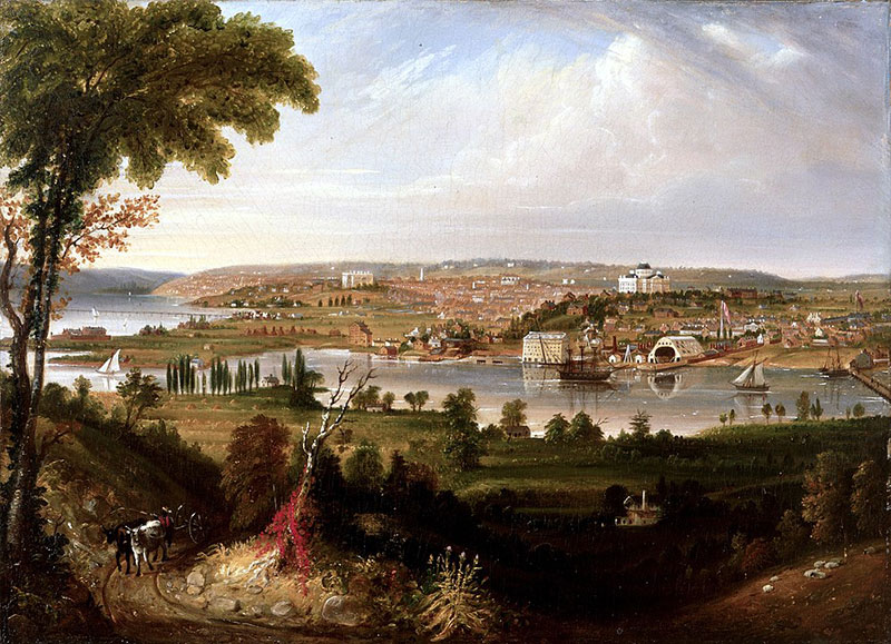
1883 painting “City of Washington from Beyond the Navy Yard” by George Cooke features Anacostia River (White House Historical Association)
The land on which the US capital city sits is cradled by the confluence of the Potomac and Anacostia Rivers. Once abundant fisheries that supported native peoples and wildlife, both rivers suffered ongoing degradation after the arrival of Europeans in the 1600s. First, forests were cleared to grow food and tobacco, causing both rivers to become choked with sediment. Fast forward to the Industrial Revolution, and things became exponentially worse. In addition to receiving increased pollution from runoff, waste, and sewage, the rivers were dredged to maintain navigability. This not only altered hydrology, but ecology, as the dredged material was placed atop tidal mud flats and wetlands. Add to that the construction of seawalls, and both rivers suffered significant wetland losses. By 1965 the Potomac had become so degraded that in a speech to governors and state officials, then-President Lyndon Johnson referred to it “absolutely disgraceful.”
Thanks to the passing of the Clean Water Act and the efforts of numerous agencies and environmental organizations, the Potomac experienced a great deal of attention and improvement in the 1970s and 80s, ultimately earning the moniker “the Nation’s River.” The Anacostia, on the other hand, remained the underdog, and became known as “Washington’s Forgotten River” or simply “one of the most polluted rivers in the U.S.”
This finally began to change in the 1987, when the Anacostia Watershed Restoration Agreement, committed the governments of the District of Columbia, the State of Maryland, and the two Maryland counties through which the Anacostia flowed- Prince George’s and Montgomery to collaborate on restoring the watershed.
A look back at one of the early efforts associated with that plan–the restoration of tidal freshwater wetlands on National Park Service property known as Kenilworth Marsh – and a look forward to a current master plan to restore the Anacostia River corridor reveal a lot about the evolution of the practice of ecological restoration.
The Anacostia’s Northwest Branch flows 21.5-miles, crossing the fall line between the Piedmont and Atlantic Coastal Plain before joining the 3.2-mile Northeast Branch just two miles from the Washington, DC border. From there, it flows southwest to its confluence with the Potomac. The river’s name comes from the Indigenous peoples who once populated its banks. Captain John Smith referred to this band of Algonquin-speaking people as the Nacotchtank when he encountered them in 1608. The name is believed to be the Latin spelling of an Algonquin word meaning “town of traders” or “trading center.” Indeed, the river was a center for trade and life for the indigenous residents. They fished its waters, harvested bounty from its wetlands, hunted its lush forests, and practiced subsistence agriculture along its fertile floodplain. Wild rice (Zizania aquatica) along with other emergent wetland plants thrived in the river’s marshes, where tidal pulses supported an abundant food web. But the arrival of Europeans changed everything for the river’s local inhabitants, human and otherwise.
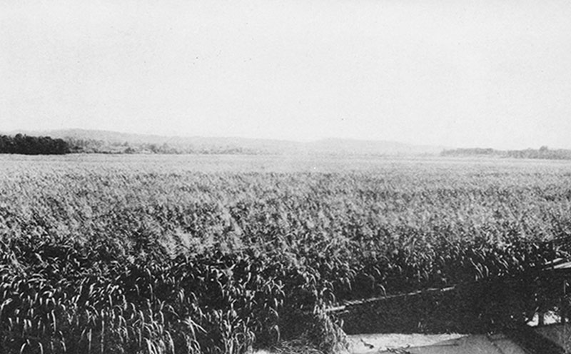
1919: wild rice (Zizania aquatica) growing in Anacostia marshes
Imported diseases such as measles and whooping cough devastated the Nacotchtank. Europe’s lust for hats made of beaver fur dramatically disrupted indigenous trade and destroyed populations of beaver which had, for thousands of years, played an important role in the river’s ecology. European demand for another product, tobacco, fueled the clearing of forests to create fields where the crop was farmed intensively. By 1670, the Nacotchtank were largely gone, driven away by encroaching settlers or killed by their diseases. Meanwhile, depleted soils from tobacco fields eroded into the river, smothering aquatic life and filling its bottom.
By the 19th century, soil was not the only thing flowing into and degrading the river. Raw sewage from the city’s growing population did as well. By the late 1800s, ongoing erosion, deforestation, and sewage flows transformed the once pristine, 40-foot-deep river to “a vast undulation of rank vegetation” (Hutchinson 1977:89) with a maximum depth of only eight feet.
To eliminate the buildup of raw sewage and maintain navigation that enabled the transport of tobacco and other goods from the upstream end of the Northeast Branch to ports across the Atlantic, the U.S. Army Corps of Engineers began dredging the Anacostia in the early 1900s. As development of the watershed increased, levees and flood walls were built along the river’s banks to control flooding. All the while, dredging continued, with dredged spoils being deposited over the levees and walls atop adjacent wetlands to create upland. With every dredge cycle, the Anacostia’s abundant marshes became increasingly separated or completely buried from the tidal pulses that enlivened them.
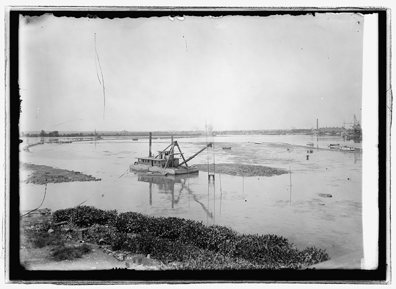
US Army Corps of Engineers vessel dredging the mudflats along the river edge across from the Washington Navy Yard. (1912) Anacostia Flats 1912. [Photograph] Retrieved from the Library of Congress, https://www.loc.gov/item/2016844607/
Inextricably linked to the environmental degradation of the Anacostia is the neglect of those who called and still call the river home. The Nacotchtank were first to experience this. The African American community was the second. The slave trade depended on rivers and the Anacostia was no exception. Enslaved Africans and their descendants arrived at ports along the Anacostia and provided much of the labor for the ever-expanding regional tobacco farms of the 1700s. Washington, DC–the seat of national politics, and overzealous tobacco and beaver pelt production-was not only a major economic port before the Civil War, but also a destination for newly freed slaves after emancipation. Racist housing policies are evident in the 1854 marketing materials for Uniontown, DC’s first suburb, which prohibited anyone of African or Irish descent in the community on the Anacostia’s eastern banks. By the end of the 19th century, similar covenants and discriminatory investment and lending practices limited housing options for Black Americans in the area. Employment along the Anacostia plummeted as job opportunities shifted to the city’s center and the river became more degraded by sediment and raw sewage discharges. Then in 1954, when the US Supreme Court outlawed racial segregation in public schools, a surge of white flight from the Anacostia neighborhoods shifted the demographics to a majority black community whose needs were increasingly ignored.
Widespread access to the automobile marked another era of discrimination and neglect of those living near the Anacostia River. Within three decades of Ford’s introduction of the Model T there were over 108,000 daily commuters to and from DC. Tens of thousands of drivers, combined with post-World War II housing and employment needs and rampant bigotry, led to hasty constructed highways and warehouse yards, crooked zoning and fire codes, and ultimately a purge of Washington’s Black residents from its center with few housing options left but the Anacostia’s east banks. In this same time period, from 1942-1968, the predominantly Black residents of the Kenilworth neighborhood along the Anacostia shared space with an open-burning landfill. To make matters worse, the city’s combined sewer overflow system often discharged into the river during heavy storms. It was in her home along the Northwest Branch of the Anacostia that Rachel Carson began writing her historic environmental and public health treatise, Silent Spring, in 1958.
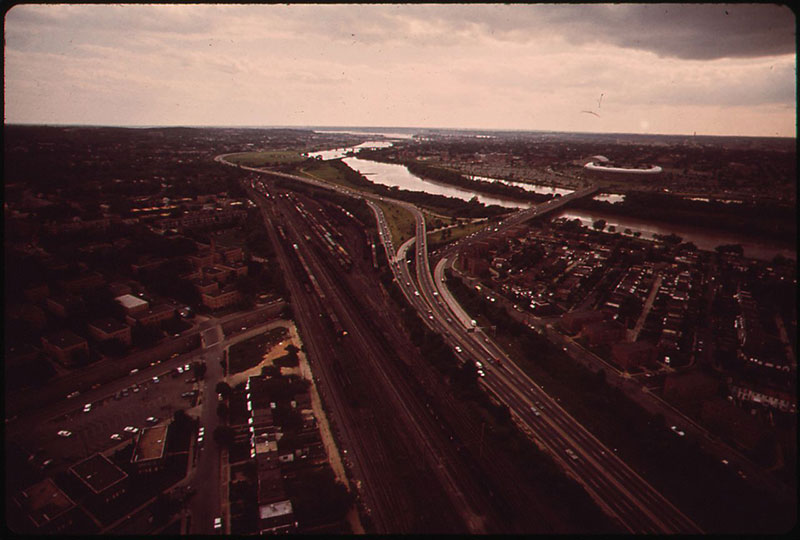
Railway tracks and the Anacostia Freeway along the river. Photo by Yoichi R. Okamoto, U.S. National Archives and Records Administration
As a result of the 1956 Highway Act, new highways provided automobile infrastructure and further concentrated and isolated impoverished neighborhoods. In DC. the Suitland Parkway, built in 1944, dissected the longstanding Barry Farms neighborhood, which still had no running water or sewer. The Anacostia Freeway, which shares a construction date with the Berlin Wall (1961), similarly blocked connections among neighbors, markets, and areas for children to play.
At the time of the signing of the Anacostia Watershed Restoration Agreement in 1987, the waterway, which had once been a critical life source for the region, had become a threat to public health and a vehicle for environmental injustice. With its legacy of sediment, pollution, and hydrological alterations associated with decades of dredging, the river was rather inhospitable for wildlife, too. With attention and funding shifting to the Anacostia, and with the formation of a multi-jurisdictional Anacostia Watershed Restoration Committee, it looked as though things were about to change.
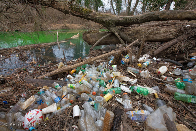
A polluted tributary to the Anacostia ©Krista Schlyer
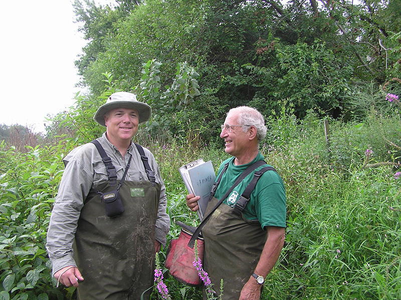
“It was an interesting period because no one had really done urban watershed restoration,” said Tom Shuler, who at the time, led the Anacostia restoration team for the Metropolitan Washington Council of Governments (WashCOG), the agency tasked with administering and facilitating the activities of the Anacostia Watershed Restoration Committee. “We had a vision about what restoration could be, but we didn’t have the resources to do the kind of master planning that was really needed.” They did, however, conduct a retrofit inventory of the 170-square mile watershed. According to Shuler, reforestation and stormwater pond retrofit projects would be initiated individually, as funds would become available. The committee launched one of the earliest urban stream restoration projects on Sligo Creek, a tributary to the Anacostia.
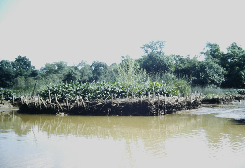
In 1989, they turned their attention to Kenilworth Marsh. Kenilworth Marsh is the ‘backyard’ of the historic Kenilworth Park and Aquatic Gardens, situated along the Anacostia River just downstream and across from the National Arboretum. As little as a 120 years ago, Kenilworth Marsh was a thriving freshwater tidal wetland along the floodplain of the Anacostia River. Tides pulsed up the Anacostia River twice a day, freely exchanging water, sediment, and nutrients with the vast complex of wetlands and riparian vegetation. After dredging began in the early 20th century, however, dredge material was commonly deposited alongside the river with little regard for the adjoining freshwater tidal wetlands or in maintaining tidal connection to these marshes.
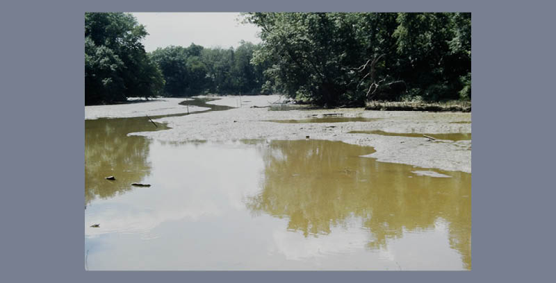
In the 1940s it was decided to dredge the Kenilworth marshes to create a recreational lake and to minimize perceived disease vectors (a.k.a. mosquitos) originating from the dying marshes. As part of the dredging process, a narrow hydraulic passage was created through the levee to allow tidal exchange with the river. Separated from the river by the levee and constricted by an uncontrolled landfill to the south and the Aquatic Gardens to the east, the lake ended up as a shallow, unvegetated mudflat with minimal habitat and wildlife value. The wild rice and other freshwater tidal wetland plants which once dominated the site had mostly disappeared.
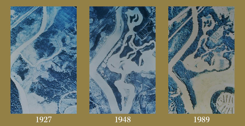
Kenilworth Marsh. 1927: before dredging. 1948: recreational lakes created by dredging. 1989: mudflats resulting from years of sedimentation
“The Kenilworth site was pretty beat up,” said Shuler. “It had sloppy sediment, very little wildlife, and a ghastly amount of trash.”
Restoring the marsh would help ongoing efforts to improve water quality and habitat in the Anacostia. In 1989, WashCOG hired Biohabitats, then a little-known ecological restoration firm, to conduct a 100-year, historical study of Kenilworth Marsh, assess its current conditions, and develop a plan to restore mid-marsh vegetation over 30-50% of the existing mudflats. The goal of the Kenilworth Marsh restoration project was to reestablish a thriving freshwater tidal wetland plant community that replicated the marsh community that existed before the seawall was built.
The team behind the project included Shuler and his colleague Dave Shepp from WashCOG, Dick Hammerschlag and Stephen Syphax from NPS, Steve Garbarino from the Corps, Jack Harper form George Mason University, and ecologist Keith Bowers, the founder of Biohabitats and its sister construction company, Ecological Restoration and Management (ER&M).
“We had a vision about what restoration could be, but we didn’t have the resources to do the kind of master planning that was really needed…”
The Biohabitats team poured over existing data, including historic documents and a rare, early aerial photograph revealing that emergent tidal wetlands, interspersed with wooded islands, had occupied the site as recently as 1927. In studying the site to determine why it was no longer supporting vegetation, Biohabitats examined the site’s soils, performed hydrologic and hydraulic modeling, and examined existing vegetation.
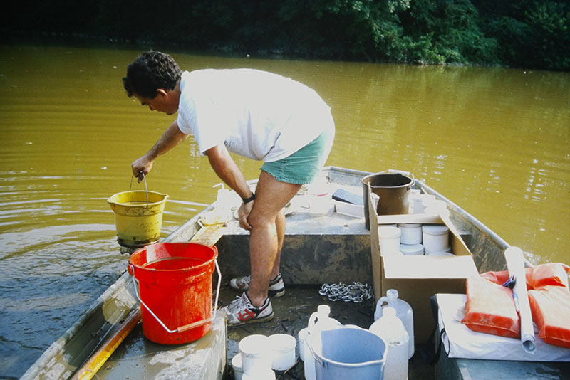
Biohabitats team member sampling water quality and sediment composition during pre-restoration assessment phase
They measured referenced systems on the fringes of the river to identify biological benchmarks and to better understand how marsh elevation and location within the marsh corresponded to plant growth and vigor. In the end, they concluded that the extensive mudflats were too low in elevation to support mid-marsh vegetation. The team could build its restoration strategy around the primary limiting factor: elevation. Biohabitats then proposed a pilot restoration effort to test different plant mixes and containment structures under several combinations of substrate elevation, solar exposure, and tidal-energy regimes.
While the site’s location on public park land helped make the restoration project possible, it also made it challenging from a permitting perspective. “The National Park Service had its legacy of land and environmental preservation,” said Shuler. “Before we could do anything, we had to demonstrate that our concepts would work.”
This meant implementing the restoration in several phases, beginning with what would now be considered an active adaptive management approach, but back then was simply thought of as a pre-design pilot project to ensure Park Service’s approval. We also learned it was one of the first large scale applied research projects focused on reestablishing tidal freshwater marsh.
Although the team had modeled marsh hydrology and hydraulics, they weren’t certain how the fill would alter tidal flow and sediment transport. “The Corps and the Park Service were nervous about filling in the marsh and completely altering its bathymetry without knowing first how it would impact existing communities of freshwater tidal plants and second, how effective it would be in facilitating the reestablishment freshwater tidal plants,” said Bowers. The team decided to create 20’ by 20’ containment cells throughout various locations of the marsh and fill them to various heights that corresponded to the biological benchmark data collected earlier. The objectives of the pilot study were to determine optimal substrate elevations, plant species, and tidal hydrology for facilitating the restoration of this marsh.
Creating containment cell walls strong and porous enough to hold the dredge material while allowing the tides to inundate it became the next challenge. The challenge was intensified by the NPS’ insistence that no artificial material, such as plastic or treated wood, be used to construct the cell walls. This led the team to think about bioengineering.
“We started thinking about creating the containment cells out of branches from discarded Christmas trees,” said Bowers, “which would naturally decompose after a couple of years in the marsh.”
The team then formulated a method to weave together woody debris (including branches of Christmas trees) and untreated wooden stakes to create brush fences capable of containing the dredge materials. They also created some cells using straw bales as walls.
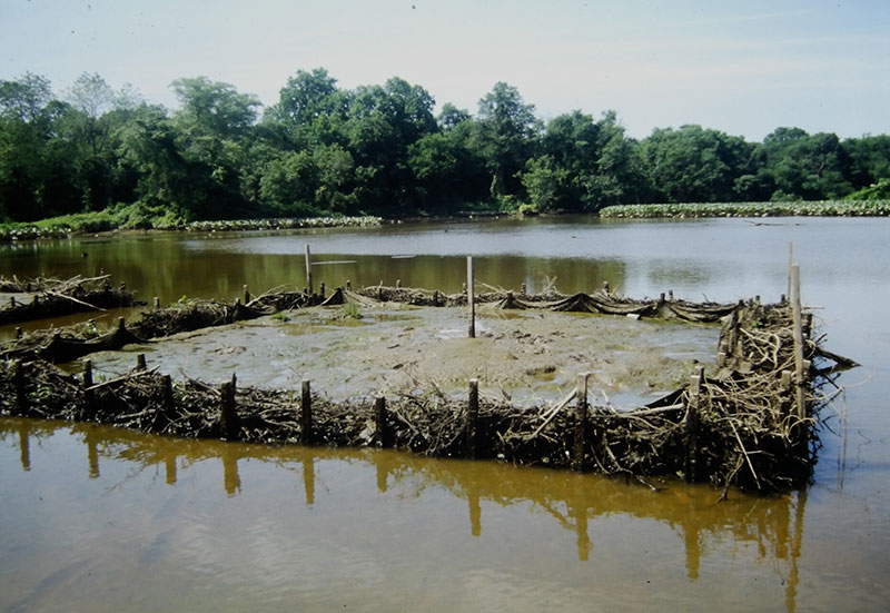
Mid-marsh cell just after it was filled to one of the pre-determined elevations with locally dredged material
Research cell after one growing season during low tide, demonstrating an optimal subsrate elevation and species composition
In total, 32 experimental containment cells, each filled to different elevations (ranging from near mean sea level to plus two feet) and planted with 10 different native plant species, were placed in the marsh—16 along the shoreline and 16 in the middle of the marsh mudflats where they were exposed to strong tidal flows.
Pre-restoration mudflats and tidal guts. Some shoreline cells in background,
“We were learning by doing,” said Shuler. And learn they did. Not only did the experiment reveal the optimum depth for reestablishing the mid-zone marsh vegetation (plant growth and survival were best at an increased elevation above 0.45m); it also showed that a severely degraded, urban freshwater tidal marsh could be restored.
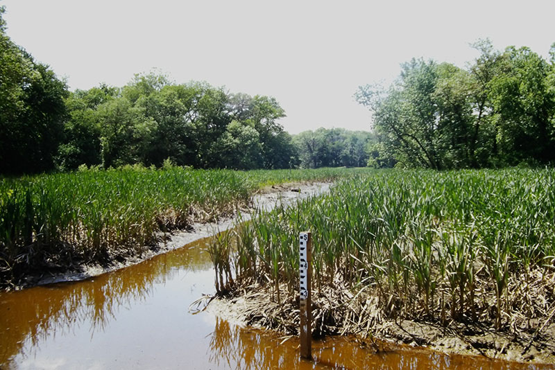
Kenilworth Marsh one growing season post restoration construction. Several tide gauges were installed throughout the marsh to monitor sediment accretion and subsidence.
“We were learning by doing…”
“We learned the marsh was pretty resilient,” said Bowers. “While there was concern about water quality, we found that if you targeted the right elevation and selected the right plant material, the existing water quality and hydraulics had little impact on marsh establishment.”
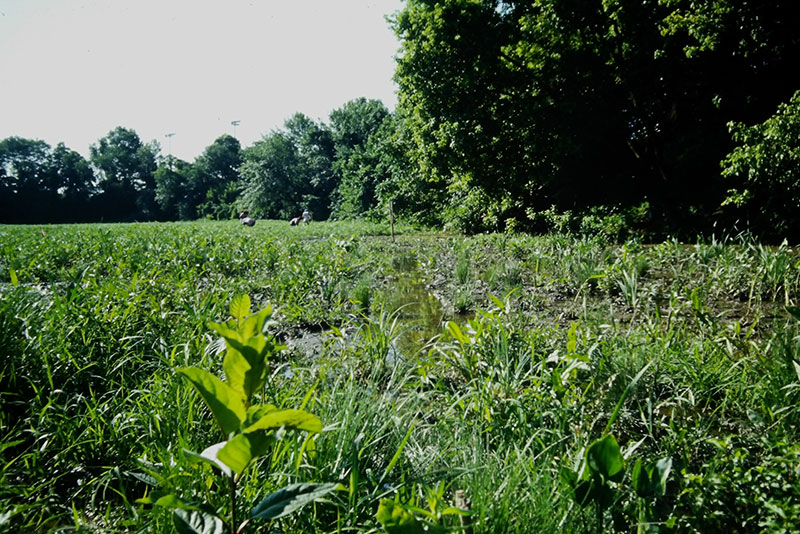
Mid-marsh freshwater tidal emergent vegetation 3+ years post restoration construction
In addition to pioneering methods that have since been used in countless other wetland restoration projects along the Anacostia and elsewhere, the experiment at Kenilworth also yielded some valuable lessons about restoring freshwater tidal marshes in urban areas. The first had to do with non-native vegetation.
“We thought about invasive species a lot,” said Bowers, “but there was no real long-term plan to manage the evolution of the marsh.” According to Bowers, seeds traveling up and down the river easily established themselves in the newly created marsh. Phragmites (Phragmites australis) was particularly aggressive. Purple loosestrife (Lythrum salicaria) and cattails (Typha latifolia), although native, also became a concern.
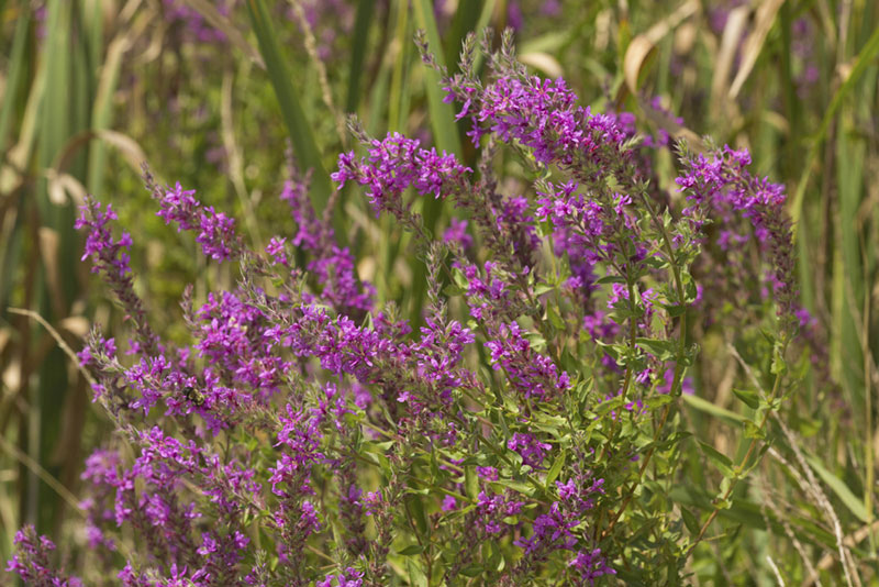
Purple loosestrife (Lythrum salicaria)
Another unforeseen factor impacting the restored marsh was herbivory by resident waterfowl. “Canada geese loved our arrow arum (Peltandra virginica) and removed most of the tubers and young plants set out on the site within weeks after planting,” said Bowers in a 1995 article about the project. This led the team to install goose-exclusion fences developed years earlier by Dr. Ed Garbish of Environmental Concern.
“Today, I always say, ‘Once you put it in the ground, you’re only 20% there,’” said Bowers, “but back then, we didn’t understand that.”
The knowledge gained from the experiment informed the design of a three-year project to scale up the marsh restoration at Kenilworth to 15-acres. The budget for that project, which included the very high cost to import dredged material, became an issue, which stalled the initiative. But right around that time, the Corps announced plans to dredge 170,000 cy from the upper reaches of the Anacostia to facilitate navigation. The Corps had already identified upland disposal sites for the dredged material, but the NPS quickly recognized that the dredged material could be the enabling factor for a much larger scale up at Kenilworth Marsh. Applying the knowledge gained from the cell experiment, the team made plans to reconstructed 32 acres of wetland comprised of two mass fill areas and fringe marsh.
“I always say, ‘Once you put it in the ground, you’re only 20% there,’ but back then, we didn’t understand that…”
In the fall of 1992, the Corps pumped 130,000 cy of dredged material into the fill areas in accordance with restoration design elevations prepared by Biohabitats. For nearly five months the newly formed marsh substrate was left fallow to allow for dewatering and settlement. At the same time, hydraulically designed tidal channels were cut into the substrate to restore tidal flow back to the system. For the Corps, this project was one of the first in the country to use the concept of ‘beneficial use of dredge material’ to restore a freshwater tidal system. The following spring, more than 350,000 native plants were installed.
Procuring and storing all of those native plants was a challenge. At the time, native plant nurseries were few and far between. Bowers recalled storing plant material in the greenhouse used by the White House. Biohabitats’ sister construction company, Ecological Restoration and Management, led plant installation. The team learned a lot about how to perform and manage construction on a daily timetable dictated by the tides. “We tried to use low tide as the middle of the workday,” said Bowers. “If low tide was at 10 am, we’d start our day at 6 am and work until 2 pm. Every day of the planting period, as the tide shifted, the crew’s workday would shift with it.”
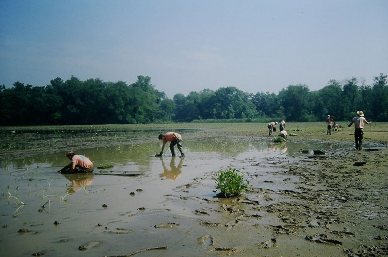
Ecological Restoration & Management field crew installing freshwater tidal wetland plants three months after placement of dredge material by the Corps
By September, birds and fish were returning to Kenilworth marsh and the plants had become established enough to provide a lush backdrop for a dedication ceremony attended by project partners and dignitaries.
“I was really proud of it,” said Bowers of the Kenilworth experiment and the restoration project which followed it.
The Kenilworth project went on to inform other freshwater tidal marsh restoration efforts along the Anacostia, including one at Kingman Island, located just to the south. Both sites became useful laboratories for local agencies, universities and NGOs to monitor and study ecological restoration in collaboration with local interdisciplinary practitioners.
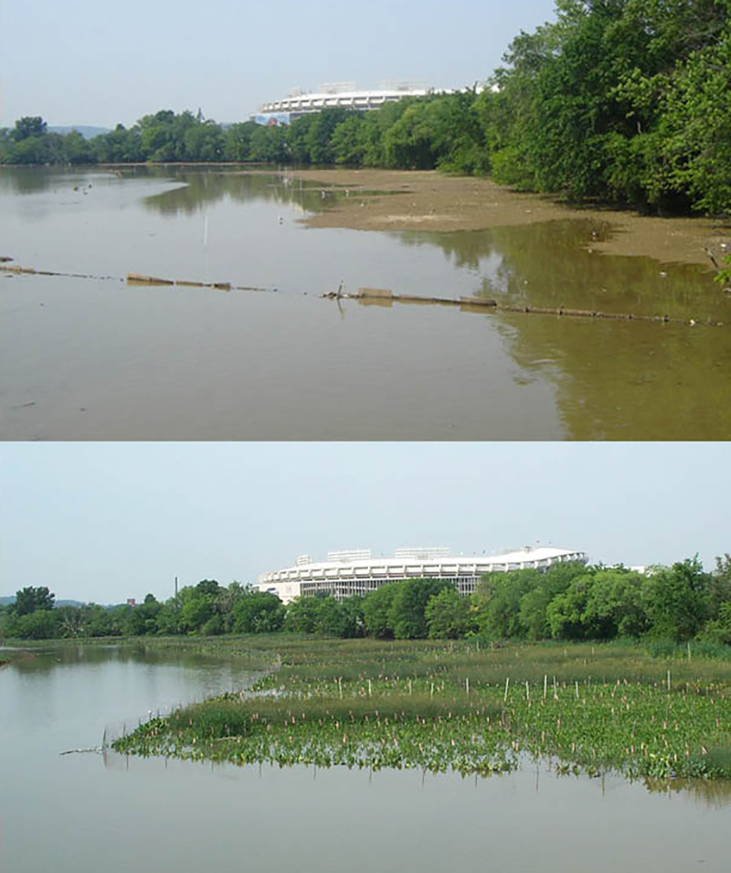
Kingman Marsh before (top) and one year after (below) restoration
An article by Andrew Baldwin of the University of Maryland, Hammerschlag, and Donald Cahoon of the Patuxent Wildlife Research Center conducted and summarized the findings of much of this research. In addition to noting the importance of goose exclusion, invasive species management, monitoring, and adaptive management, they concluded that a phased approach is likely to improve restoration success. They also concluded that clear and realistic criteria for success and the selection of appropriate urban reference sites are essential.
“If you want to achieve something, achieve something realistic” said Baldwin, who also studied both sites. Baldwin spent several years studying the seedbanks at Kenilworth and Kingman, along with a rural and urban reference site. “The diversity and abundance of the seedbank was higher than those at the rural site,” said Baldwin. When it came to non-native species, however, the need to look at a representative reference site also became clear to Baldwin. He noted that invasive species such as purple loosestrife, Phragmites and reed canary grass (Phalaris arundinacea) existed at the more urban reference sites. “You can’t restore beyond the constraints of an urban environment,” he said.
Andy Baldwin (C) and graduate students at Kenilworth Marsh collecting soil samples for microbial analysis.
Baldwin’s undergraduate and graduate students have been able to examine that lesson and many others by continuing to visit Kenilworth Marsh. “For students to be able to see what goes into urban tidal marsh restoration projects is wonderful for education,” he said. The site also presented opportunities for students to learn how to do things like set up vegetation plots, do species composition, and collect soil samples and analyze them for bulk density and organic matter content. “Students are still studying it,” Baldwin said of Kenilworth Marsh. One of his recent graduate students, studied the effect of vegetation on the distribution of microplastics.
Baldwin commends the Kenilworth restoration for linking academia with restoration practitioners and credits Hammerschlag and the NPS’ Center for Urban Ecology.” Kenilworth was an early example of the kind of partnership that can really help us improve restoration,” he said.
Andy Baldwin (L) and Dick Hammerschlag (R) at Kingman Marsh in 2002
Looking back at the Kenilworth project from a distance of 30 years, however, reveals the absence of another kind of partner that we now know can greatly improve restoration: the local community.
“Unfortunately, residents were not at all involved in the project,” said Bowers. “Even if they had wanted to come to check out the restoration, physical barriers such as highways and fences impeded access to the site.”
Baldwin remembers chatting with residents who walked through the Kingman site, which was slightly more accessible, and being asked if the recently planted vegetation was edible. “They thought we were farming,” he said.
“Restoration wasn’t as inclusive as it is today,” said Bowers. “We would take a whole different approach now.”
“Restoration wasn’t as inclusive as it is today…”
Indeed, a different approach is exactly what the District Department of Environment and Energy (DOEE) and Biohabitats are taking currently as they begin work on a holistic master plan for the DC portion of the Anacostia River corridor within the 500-year floodplain. With DC stream and wetland restoration funding and through a National Fish & Wildlife Foundation Chesapeake Bay Small Watershed Grant, DOEE is aiming for a plan that will not only lead to improved water quality and restored habitat, but increased and improved public access to a healthy river and climate resiliency for the river and its neighboring communities.
“The Anacostia River has historically been thought of as a barrier that divides the city,” said Steve Saari, Associate Director for Watershed Protection at DOEE. “We want to turn that around. We want to make the Anacostia River a focal point, something that unifies the city.”
Just as the Anacostia is known as “the other river,” the communities on its east side are often collectively referred to as “East of the River,” rather than by their individual neighborhood names. According to Saari, improving the Anacostia not just for better water quality and habitat, but also for the benefit and resilience of those communities aligns with many other efforts by the City to right historic wrongs and focus resources in underserved communities. He acknowledges that momentum in addressing equity issues accelerated with the Black Lives Matter movement.
The project partners recognize how the river can benefit from a community that is reconnected to it. “Bringing people to the river makes people advocates for the river,” said Saari. But this can only be done effectively with the input and involvement of the people in those communities.
“There definitely was a time when this kind of work was very much top down and done by the government without much consultation,” said Saari. “But there is a lot to learn from the people who live here.”
It makes sense, then, that development of the master plan not only involves the analysis of a diversity of available data, but the inclusion of a diversity of community voices.
“It always amazes me how much we don’t know,” said Saari. “There is a lot of information we can draw on from maps and natural history surveys, but nothing beats that eyes-on, personal experience people have. That often isn’t recorded, especially in underserved neighborhoods.”
In addition to ensuring that the plan is informed by such knowledge, the project team wants to understand how the community envisions a healthy, accessible river. They want to learn for example, how local residents and community groups currently access the river—both physically and visually—and how they would like to do so in the future.
“It always amazes me how much we don’t know…”
Saari believes that the involvement and input of local residents in the planning process will not only lead to a better understanding of the river and its history, but also of the ways in which the river can become a long-term, sustainable community amenity. “I very much look on engagement as a two-way street,” he said.
While the project team gains knowledge from the community, local residents will have opportunities to learn about what science reveals about the river’s past and future—including a projected 6 to 11-foot sea level rise in the region by 2100.
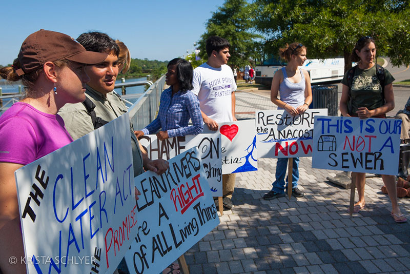
Anacostia River advocates speak out for river cleanup during an event in 2011. ©Krista Schlyer
“Engagement is envisioned to be ongoing,” said Jennifer Dowdell, an ecological planner who is managing the effort for Biohabitats. According to Dowdell, the desires and ideas of the community will be woven into the master plan.
“I very much look on engagement as a two-way street…”
Both Saari and Dowdell acknowledge that there can be tension between public access and restoration needs. For example, citizens may be concerned that establishment of a living shoreline or fringe wetlands might block their view of, or access to, the river. But learning and discussing such things in advance enables creative solutions like boardwalks or special access points. The plan aims not only to reconnect a resilient, healthy river to those living in its 500-year floodplain, but to do so in ways that reflect what they seek in this reconnection.
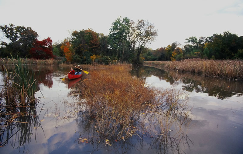
Paddlers in Kenilworth Marsh, 2002
“There is this integrated understanding of the community’s need to access and enjoy the benefits of a healthy river,” said Dowdell. “I see a great deal of energy and passion from our clients at DOEE, making sure that a diversity of voices in the local community is represented throughout the planning process.”
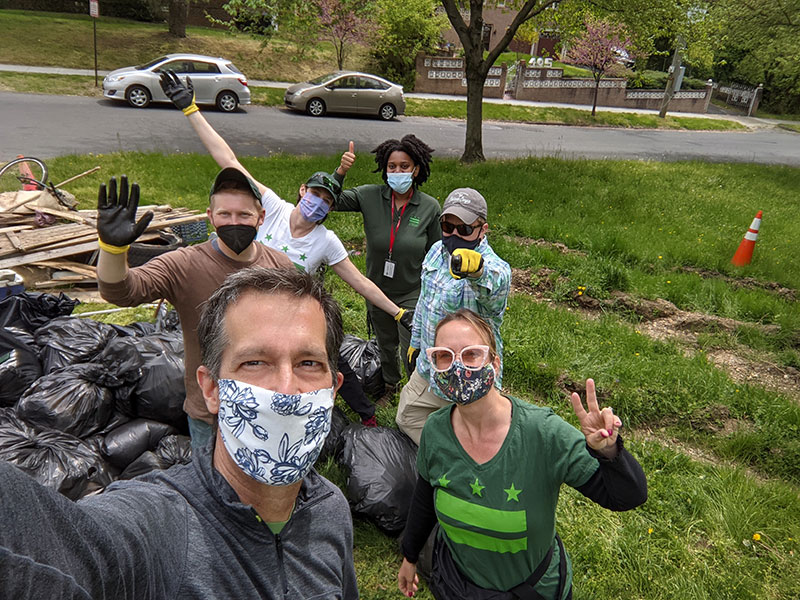
Steve Saari (foreground) and other DOEE team members at a voluntary cleanup in the Anacostia watershed
The composition of the project team, particularly in comparison to the Kenilworth Marsh project team of 1989, reveals another way that restoration has evolved to be more inclusive. Beyond the dredging, the Corps was somewhat off to the sidelines back in 1989, according to Bowers. So too were and city and regulatory agencies. “We huddled with WashCOG and the NPS to develop and implement the work,” said Bowers, “and then we reported out to other agencies.”
Led by DOEE and managed by Biohabitats, the master plan team not only includes Limnotech, who provides expertise in the analysis of existing GIS data and ecological trends in the Anacostia system, but the local office of CHPlanning, a well-established, minority-owned firm that knows the people, community organizations, and neighborhoods of the Anacostia. CHPlanning is leading public engagement and communication with the support of the Anacostia Watershed Society and design input from Lee and Associates, a DC-based, minority owned landscape architecture firm with expertise in visualization and understanding community needs of designed spaces. The team also includes the Low Impact Development Center, who has a depth of expertise in local climate change trends.
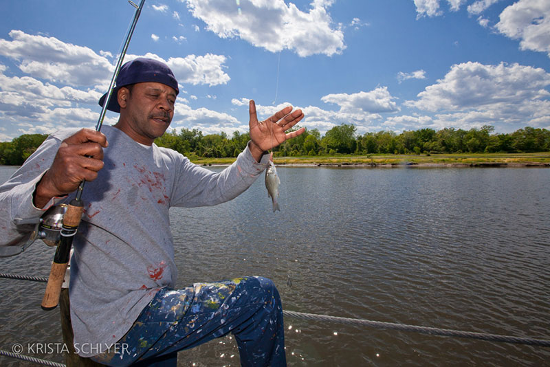
Fishing along the Anacostia ©Krista Schlyer
DOEE is also convening a Stakeholder Advisory Council, to further ensure that a diversity of community voices contribute to the master plan. The Council will help DOEE continue to establish greater connections in the community.
“With the Stakeholder Advisory Council, we will have a diverse group from the community that is engaged with our team prior to any public in meetings or surveys,” said Dowdell. “They will help guide us in language, in understanding how the community already perceives issues in the corridor, and in ensuring we have a wide variety of voices giving input.”
The final product of the master planning effort, a map illustrating a variety of opportunities for improved access and ecological restoration to support improved water quality, habitat and resilience, is expected to be completed in 2023. The master plan is preceded by work done to address the river’s visual blight and bacteria. Work resulting from the master plan will occur concurrently with a separate effort to remediate toxic pollution.
“Very few major cities in the world have natural, free-flowing rivers that are bordered by almost all parkland, like we do with the Potomac and Anacostia” said Saari. “That is something we should be embracing. The Anacostia can be a defining feature of the city and both a point of pride and resource of the community.”
As ecological restoration’s lens has widened to include the social landscape and the realities of a changing global climate, so have restoration goals for sites such as the Anacostia River.
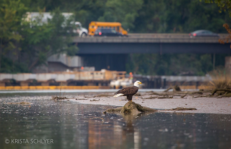
Bald eagle (Haliaeetus leucocephalus) on the Anacostia River. ©Krista Schlyer