Building Water Consensus in Colorado’s Front Range
By Amy Nelson
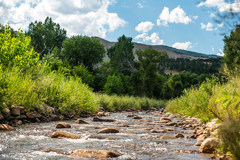
When it comes to water along Colorado’s Front Range, the span of uses, needs, and priorities is as sweeping and dramatic as the landscape itself. This is distinctly evident in the St. Vrain Creek drainage basin. From the headwaters of the North St. Vrain Creek in Rocky Mountain National Park, through narrow foothill canyons, across the alluvial fan, and extending eastward into the high plains, the watershed spans a massive expanse of land. Its waters, which ultimately flow to the South Platte River, provide critical habitat for fish and wildlife, including species such as the plains minnow (Hybognathus placitus) and the State endangered northern redbelly dace (Chrosomus eos).
Those same fluvial systems are relied upon to irrigate crops in one of the most productive agricultural counties in the United States and to provide drinking water for more than one hundred thousand people in the basin’s rapidly urbanizing section. They also support a thriving tourism industry, drawing anglers, hikers, bikers, and whitewater kayakers from all over the world. Included within the St. Vrain basin is the 76-square mile watershed of Left Hand Creek. Along with their tributaries, the St. Vrain and Left Hand creeks do a lot of heavy lifting. Accommodating and balancing the basin-wide water needs of federal agencies, rural mountain towns, farmers, ranchers, recreational groups, growing municipalities, industries, and of course, ecosystems is no easy assignment, particularly in a state where rights to water are governed by a doctrine of prior appropriation, which is also known as “first in time, first in right.” [Click here for more details on Colorado’s water rights] Further complicating water management in the basin are projections of population growth and increased occurrences of drought, flooding, and wildfire.
Managing these needs and issues while ensuring that the basin’s waterways continue to support the overall health, biodiversity, character, and economy of the region is the work of many nonprofits and local units of government, including the St. Vrain and Left Hand Water Conservancy District (District) and the Left Hand Watershed Center. It is work that is not only complex, but fraught with emotion and potential for conflict.
“There’s a saying in the West that ‘whiskey is for drinking and water is for fighting,’” said Sean Cronin, Executive Director of the District. “It’s a limited, precious resource, and people have passionate feelings about how it gets used.”
Those feelings may cause conflict not only among different stakeholder groups, but within their subcategories. Take the recreation stakeholders, for example. Through a trans-mountain diversion, St. Vrain Creek includes a kayak course in the town Lyons: one of the only places in the Front Range that offers a whitewater experience in October. According to Cronin, conflict has existed between the whitewater course kayaking community and the fly-fishing community because they both have very different hydrology desires.
“We learned in the flood that individualism, which is a very cherished Western quality, doesn’t help when you’re all brought to your knees,”
Since it was founded in 1971, the District had been managing each stakeholder need separately. That changed, however, when a catastrophic flood devastated the basin’s ecology, infrastructure, and communities in 2013.
“We learned in the flood that individualism, which is a very cherished Western quality, doesn’t help when you’re all brought to your knees,” said Cronin. “We had to learn to work together, and that was a new muscle for a lot of stakeholders, communities, organizations, nonprofits, and government sector folks.”
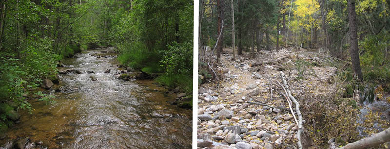
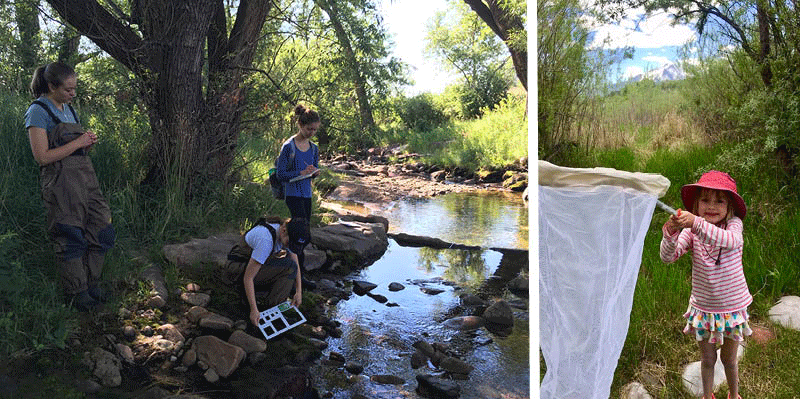
That need to work together was immediately put to the test in the Left Hand Creek watershed, which, like many of the creeks along the Front Range, suffered from flood-related devastation. The creek itself experienced extreme erosion, deposition, and habitat degradation. The surrounding community suffered losses of roads, property, and human life. The devastation prompted an urgent need for restoration. With funding from the State, Boulder County quickly launched an effort to assemble stakeholder coalitions and develop watershed master plans in the affected watersheds to guide long-term restoration. In the Left Hand Creek watershed, the coalition was comprised of a diverse group of 22 stakeholders. In 2014, they completed the Left Hand Creek Master Plan. The Lefthand Watershed Oversight Group, now known as the Left Hand Watershed Center (Watershed Center), was tasked with implementing the plan and its $9.5 million restoration projects. The projects were designed to reduce future flood risk while restoring the creek’s ecology and enhancing the health and safety of landowners living along the creek and its tributaries.
At the helm of these restoration projects was Jessie Olson, Executive Director of the Watershed Center. Under her leadership, the Watershed Center has completed 11 restoration projects on privately owned land to date and initiated an additional nine. While the flood was an eye-opener for the creek’s many communities and stakeholders, flood recovery stream restoration efforts were not without conflict.
According to Cronin, who is also a member of the Watershed Center’s diverse board of directors, much of the conflict stemmed from a lack of knowledge among stakeholders and community members about what stream restoration really means and looks like.
“Stakeholders or property owners would come out during the design, construction, or ribbon cutting and say, “Well, that’s not what I thought it was going to be.”
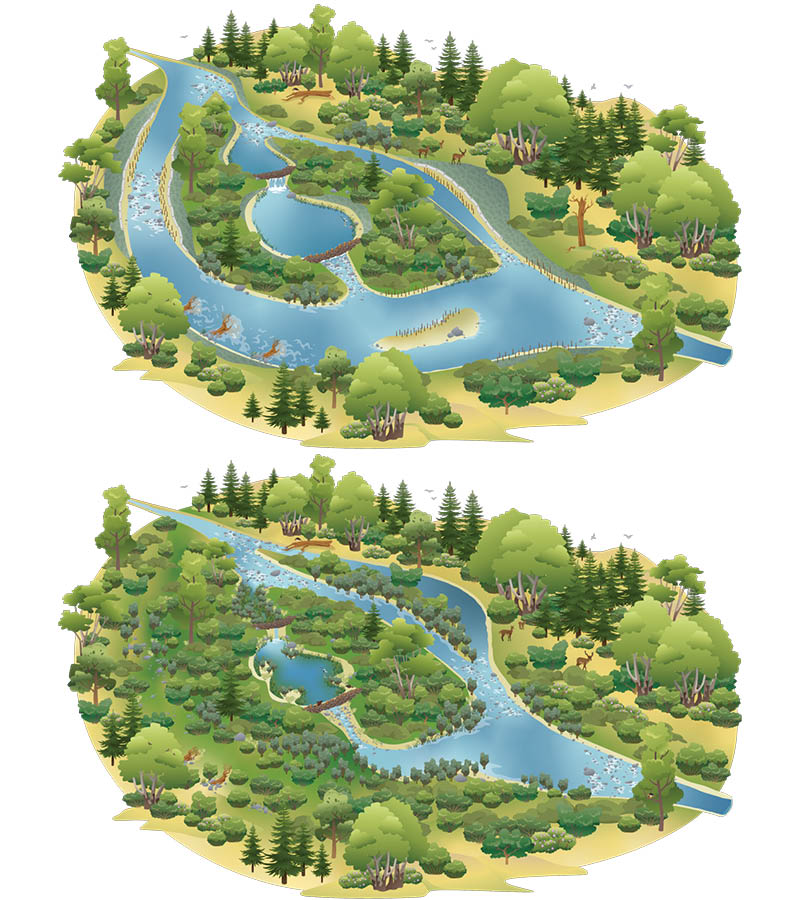
In order to prevent such conflict in its ongoing restoration efforts and in the adaptive management of the completed projects, the Watershed Center staff worked hard to develop communication tools to help people visualize what the restored stream would look like and to facilitate a better understanding of the complexities and challenges of design and construction processes. Those complexities can be difficult for any layperson to understand, especially when some designs are based on a “stage-zero” approach. This approach, which the Watershed Center embraces, restores the stream in a way that enhances its resilience by promoting the establishment of a dynamic, multi-threaded channel with a broad floodplain and complex habitats.
Olson also sought conflict resolution training for herself and the Watershed Center staff. She found it in a workshop hosted by Rocky Mountain Chapter of the Society for Ecological Restoration. The workshop’s featured guest speaker was Nina Burkhardt, a Research Social Scientist at the USGS’ Fort Collins Science Center. Burkhardt’s work focuses on climate change adaptation, negotiation and conflict resolution, and the use of science in decision-marking in the context of public land management. Olson found her insight particularly compelling and relevant.
“It was so helpful,” said Olson of the training workshop. “I wish that I had received the training before implementing the first set of projects.”
In the training, Olson learned about the “conflict resolution triangle,” which consists of trust, process, and outcome. “Experts who study conflict resolution find that if you build trust with the people with whom you are working, and the process is clear and fair, the outcome will matter less to those who are participating,” she said.
Olson is now applying that wisdom, along with the lessons learned during the first restoration project, to advance the Watershed Center’s ongoing restoration projects, as well as to its efforts to enhance watershed-related knowledge and stewardship through watershed and community science and engagement.
“We now focus very heavily on communicating and building trust among the people involved up front,” she said. “We spend a lot of time explaining the process to make sure it is very clear and fair.”
With restoration projects, that process now begins with the creation of a team that includes the landowner and the clarification of each team member’s roles and responsibilities. From the outset, teams establish a communication protocol and review it before every meeting. The revamped process also provides multiple opportunities to landowners and stakeholders to participate in the conceptual design process and actually sign off on each stage of design documentation.
“Having those clear checkpoints along the way helped the design and helped build trust,” said Olson. “People had an opportunity to voice their opinions, and they knew that they were actually heard.”
“It’s all about communication, communication, communication”
According to Olson, the conflict resolution training and communication tools are paying off. So far, post project surveys have all been positive. “Everybody seems happy,” said Olson.
“It’s all about communication, communication, communication,” said Cronin. This includes letting people know that nothing is going on during the times when there is no project news or action. “Having radio silence at any one point can result in people going to a dark place of conspiracy theories.”
With much of the flood recovery restoration work complete, the St. Vrain basin–and the state of Colorado in general–is pivoting from a focus on urgent recovery to one on long-term resilience.
Engaging an entire community is difficult. But for the multiple stakeholders tied to the fate of the creeks, the flood was an awakening of their need to understand their watershed and find solutions in the face of growing water demands and climate change capable of accommodating the needs of each constituent, including the river itself.
Just as the 2013 flood catalyzed cooperation, so too have the growing demands on and looming threats to Colorado’s natural water supply sparked a collaborative effort to build resilience. In 2013 Colorado’s governor called for the creation of a strategic plan to address the growing strains on the state’s water. Stakeholders from all of the state’s river basins collaborated to produce the Colorado Water Plan, a roadmap for addressing projected water needs. Among the plan’s objectives was the goal to develop Stream Management Plans (SMP) to address local concerns such as fire mitigation, water quality impairments, potential impacts of legacy mines, flood mitigation and recovery, aquatic and riparian habitat enhancement, and land use change for 80% of locally- prioritized rivers and streams.
The first of such streams on the Front Range to receive SMP grant funding was St. Vrain Creek (including Left Hand Creek). Leading the two-phased, five-year effort is the St. Vrain and Left Hand Water Conservancy District. The plan will include South St. Vrain Creek, Middle St. Vrain Creek, North St. Vrain Creek, and the main stem of St. Vrain Creek to its confluence with the South Platte River, as well as Left Hand Creek.
“Part of the reason we were first was that we had already built strong relationships with all of these varied stakeholder groups,” said Cronin. “We had many years working together through flood recovery.”
Yet Cronin knows that the creation of the SMP will involve a great deal of consensus building. “Are we going to have people that say, ‘Hey, I don’t like the plan’ or “I don’t like this piece of the plan?’ Sure. Are we going to have people say, ‘I didn’t know you were doing a plan?’ Sure,” he said. “But the way I look at it is, ‘Let’s do that plan and have that discussion. What is it about this plan that you find offensive or doesn’t marry with your value system? Let’s talk about that. And are we going to make everybody 100% happy? I doubt it. But can we manage the river such that there are opportunities for enhancement on all levels? I do think we can get there.”
One area where opinions may differ among stakeholders is climate change. Cronin’s strategy for handling those differences is to simply avoid using the words. ” I just don’t mention ‘climate change,’” he said, “because it just becomes a political hot potato.” Instead, he asks folks for stories. He shared an example:
One area where opinions may differ among stakeholders is climate change. Cronin’s strategy for handling those differences is to simply avoid using the words. ” I just don’t mention ‘climate change,’” he said, “because it just becomes a political hot potato.” Instead, he asks folks for stories. He shared an example:
“Generational farmers used to talk about being protected from storm clouds from the west by the shadow of Longs Peak, a 14,000-foot peak in the Rocky Mountain National Park. You didn’t see storm events like we have seen in the last decade. Now, hailstorms are becoming more frequent. I recently spoke with a homesteading farmer who had looked back at his family records and learned that there were no records of hail hitting their property until two years ago… when it happened twice.”
While climate change modeling is not included in the SMP, these stories are informing the Plan. “Everyone’s living it so we don’t necessarily have to have models to show what the future holds,” he said. The District is monitoring other climate models, science, and data, and that is showing that water yield could decrease or change in its timing. Those changes will affect the delivery and legal administration of the water.
But Cronin is an optimist and views these challenges as an opportunity. “It’s a chance for us to sit down and ask, ‘Are we prepared? Are there things we can do now to better maximize our ability to produce water for the needs that we value?’ There is a recognition that things are changing, and whether those changes are human-caused or a short blip, people seem to want to get involved in a conversation about being prepared.”
While Cronin admits that phased planning, as is being used with the SMP, can often lead to can-kicking difficult decisions to future phases, it does offer a flexibility that helps when it comes to consensus building. “This is not a one-and-done thing,” said Cronin. “Let’s set the baseline understanding and talk about our goals. Then let’s go into the next phase, refine that, and perhaps pick a few projects,” he said With the initial assessment phase and report nearly complete that next phase should begin this spring or summer.
Meanwhile, Olson and the Watershed Center are continuing their work in watershed science, restoration, stewardship, and community science, and expanding it to other watersheds. They are currently working a basin-wide project called “Adaptive Management at Scale,” an effort to build consensus around the metrics that people want to use year after year to gauge change in stream systems.
Bringing parties together to not only do the work, but providing funding for it, is going well, according to Olson. “The fact that our partners are supporting this project and understand that it’s needed shows me that science is valued,” she said. “Having a common language and understanding of the trajectory of our watershed and how we might be able to change that through restoration and management is really exciting.”
Collaboration between the Watershed Center and the District has been a silver lining to come from the devastating 2013 flood and the challenges of an uncertain future. “It creates for a better synergy between the two entities and better outcomes for the basin,” said Cronin.
That is not to say there is never conflict between Cronin and Olson and their organizations. “We are both leaders in the community wanting to do a good job for the brand that we carry,” said Cronin. “If we can say, ‘Geez, maybe together we’re a stronger team,’ conflict can actually be a good thing.”
Indeed, the conflicts and unprecedented complexities and challenges of water management along Colorado’s Front Range have created unprecedented demonstrations of cooperation, stewardship, and progress by the Left Hand Watershed Center, St. Vrain and Left Hand Water Conservancy District, and the varied stakeholders, landowners, and communities they serve.
